Who's onlineThere are currently 0 users and 0 guests online.
User loginBook navigationNavigationLive Traffic MapNew Publications
|
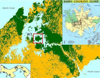
Barro Colorado Island 50 ha plot grids
Short title:
BCI_grids Barro Colorado Island 50 Hectare Plot Data set (Panama) that contains about 2 million records --- complete inventory of all plant species and numerous plant and environmental attributes for six time periods. Here can be obtained 13 auxiliary grids (soil parameters, DEM parameters) that can be used to improve spatial distribution modelling of sampled species. Available layers:
Spatial structure:
proj4:
NA
Location:
Panama
9° 9' 4.5" N, 79° 51' 19.08" W
Data owner:
Center for Tropical Forest Science of the Smithsonian Tropical Research Institute
(1 vote)
|
Testimonials"Just a short word of congratulation about the open-source book project you launched yesterday; this is exactly the idea I have of the word ‘research’ (especially as a free-software advocate myself!), will try to help as much as possible." Poll |


Recent comments
8 years 26 weeks ago
8 years 44 weeks ago
9 years 4 days ago
9 years 13 weeks ago