Who's onlineThere are currently 0 users and 2 guests online.
User loginBook navigationNavigationLive Traffic MapNew Publications
|
US environmental grids 5 km
Short title:
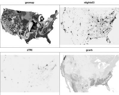
USgrids5km For the purpose of mapping heavy metal concentrations, a list of environmental predictors have been prepared using the data available from the USGS and the National Atlas. Available layers:
The dataset consists of 14 gridded maps, possibly extendable to 130 grids if one also includes the indicators. Description of each grid is available in the *.rdc file.
Spatial structure:
proj4:
+proj=aea +lat_1=29.5 +lat_2=45.5 +lat_0=23 +lon_0=-96 +x_0=0 +y_0=0 +ellps=GRS80 +datum=NAD83 +units=m +no_defs
Location:
United States
Data owner:
USGS / National Atlas
Reference:
|
Testimonials"I've been looking at your book - I think it provides nice introductions to some important topics. I'm impressed that it's free!" Poll |


Recent comments
8 years 35 weeks ago
9 years 1 week ago
9 years 9 weeks ago
9 years 21 weeks ago